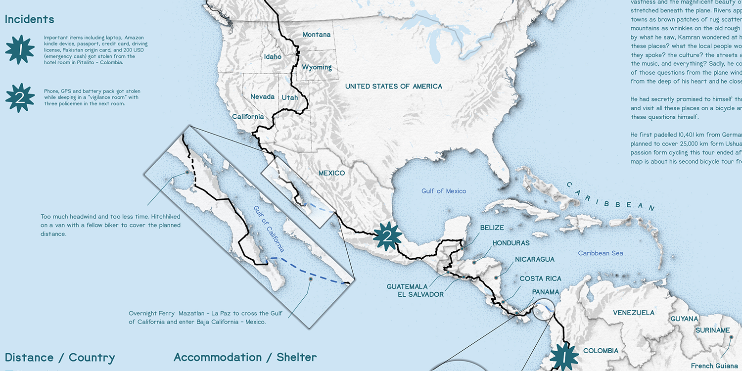
Maps tell stories—and this map tells an inspiring story of chasing dreams. When I got the chance to map a travel journey, no story resonated more than Kamran’s extraordinary adventure of cycling around the world. I reached out to Kamran on Bike, and he generously allowed me to use his journey data for this project.
Data is the cornerstone of any map. For this project:
Creating a map that spans two continents poses both technical and design challenges: The projection needed to preserve distance—critical in representing a journey like this. I chose a customized projection from Projection Wizard by Bojan Šavrič, which provided the best balance for visual and spatial accuracy.
High-resolution satellite imagery was initially considered for the basemap. However, due to data size and processing limitations, I had to abandon this approach.
Instead of using a Digital Elevation Model (DEM)–derived hillshade (which is resource-intensive), I employed a creative workaround: I used a hand-drawn hillshade by Ellen Kuzdro, which resembles a pencil-drawn landscape. This hillshade was geographically referenced and enhanced in GIS, resulting in an efficient, aesthetically pleasing backdrop.
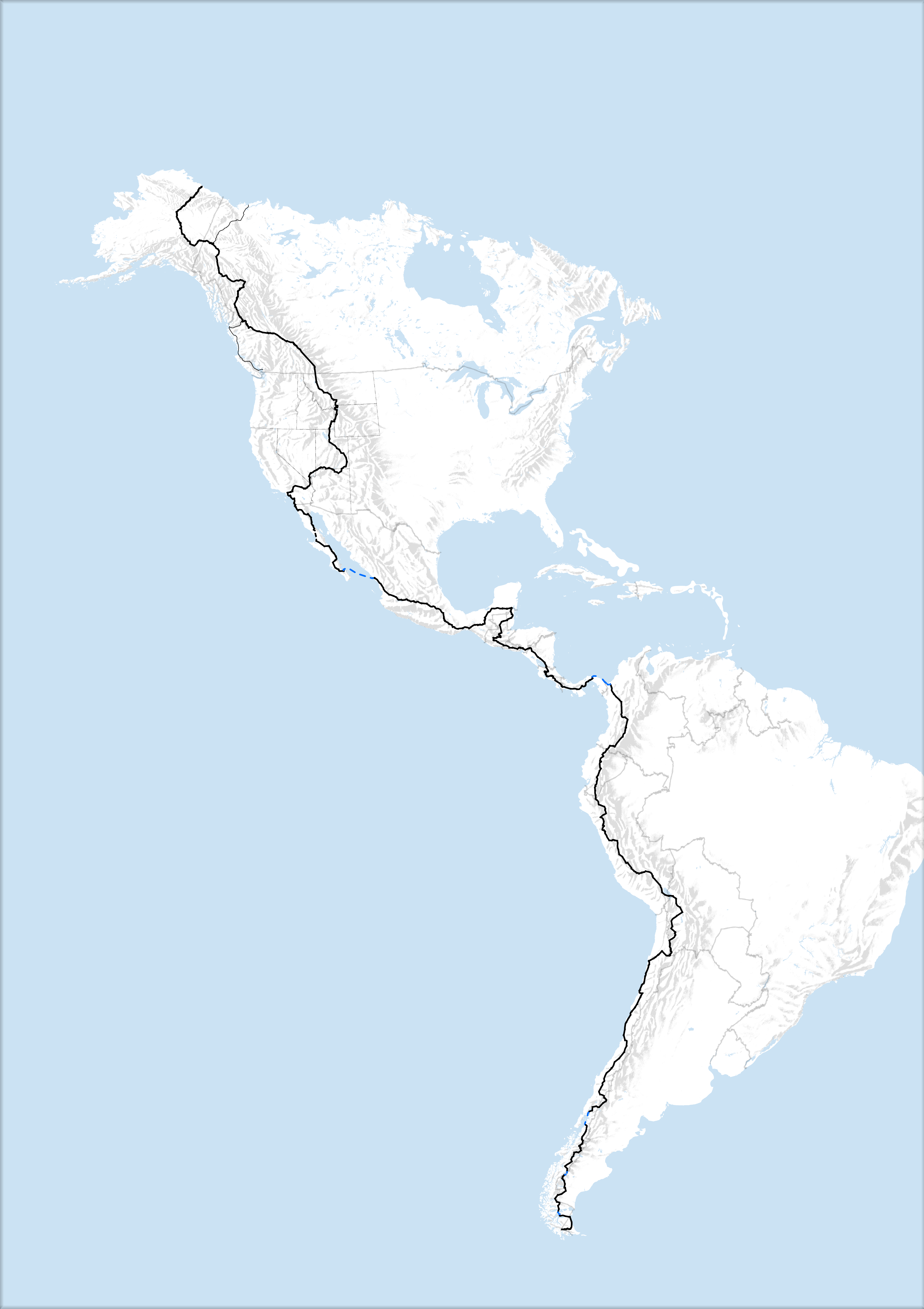
Kamran’s GPS track was the heart of the map. However, due to the small scale of the map and the complexity of the actual path, I had to simplify the route: Several generalization techniques were tested. The final path was chosen to maintain both visual clarity and route fidelity while fitting the overall map design.
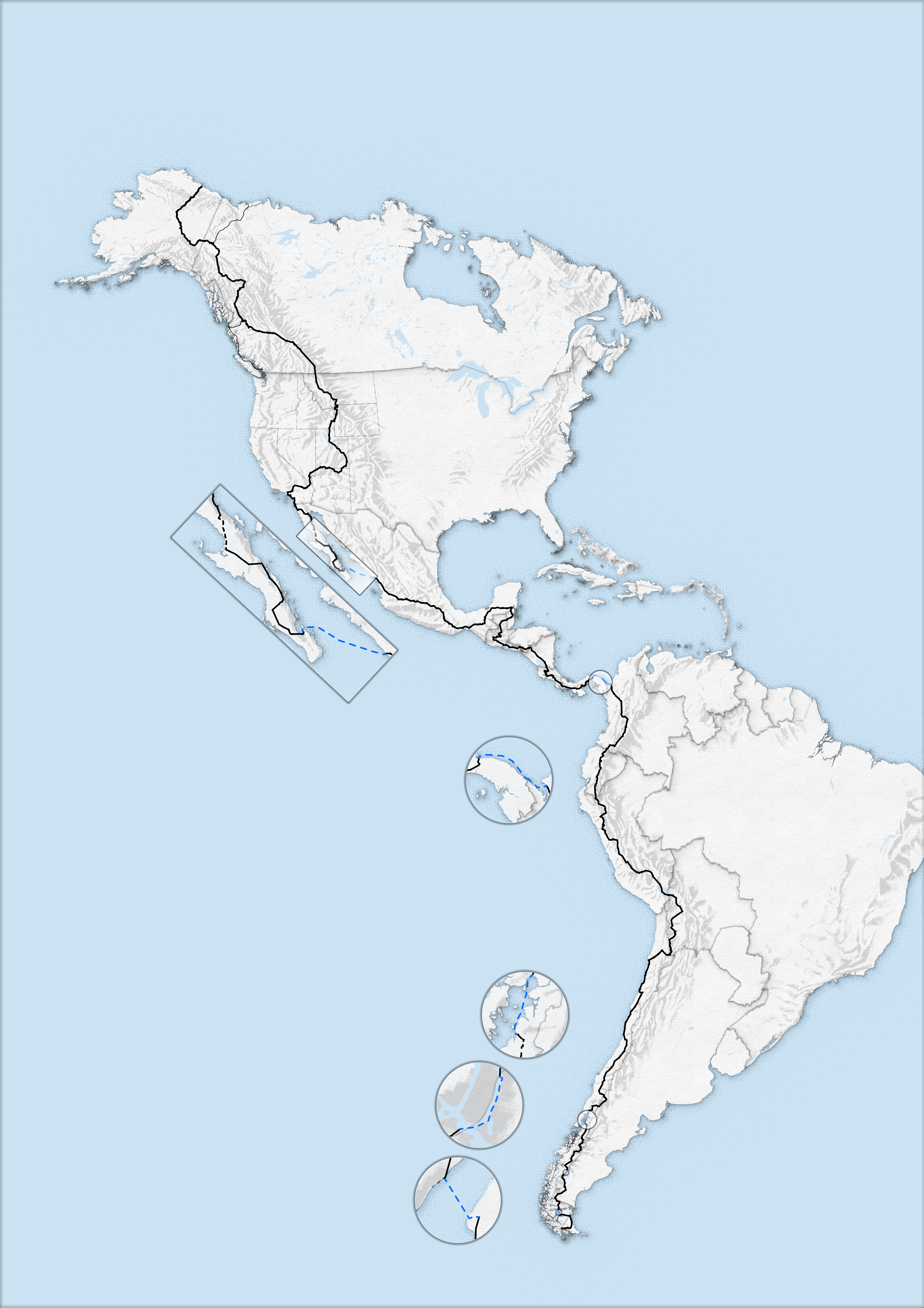
To show journey segments where Kamran did not travel by bicycle (such as ferry rides or hitchhiking), I added inset maps: Inset maps were visually differentiated using a mirror effect. Country borders were enhanced with depth effects. Shorelines were highlighted using a subtle shoreline glow for added clarity. These visual elements were inspired by the work of two of my favorite cartographers: John Nelson and Sarah Bell.
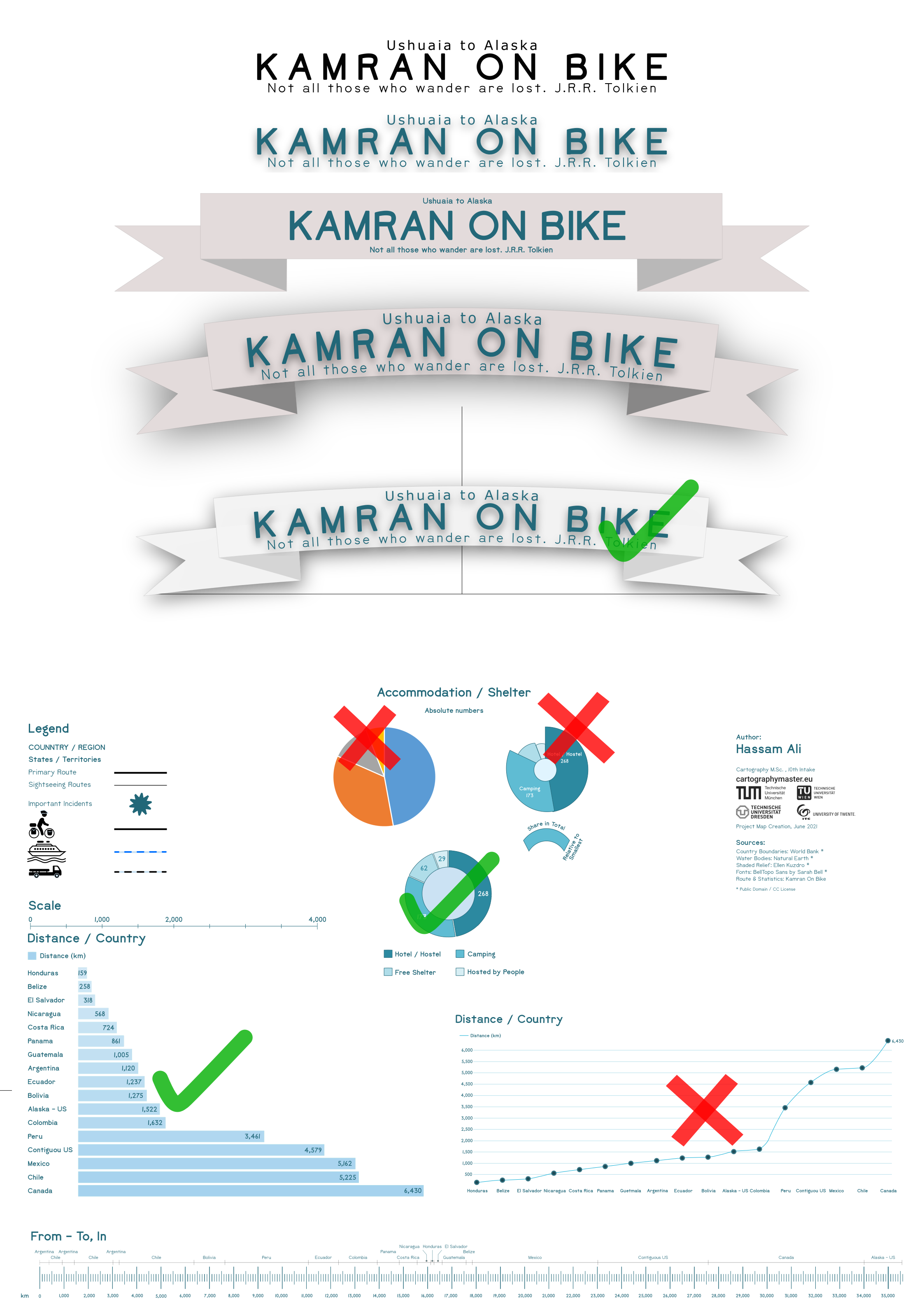
Once the basemap was complete, I transitioned from ArcGIS Pro to Inkscape for layout design: Added titles, charts, and graphs showing various statistics about Kamran’s journey. Experimented with different styles and layouts, finalizing them based on visual feedback. Inserted essential map elements such as the legend, scale bar, and directional indicators.
The final product is more than a map—it’s a visual story of determination, human endurance, and global exploration. Despite technical limitations and design compromises, the project reflects the essence of Kamran’s inspiring journey and demonstrates how cartography can be a powerful storytelling medium.
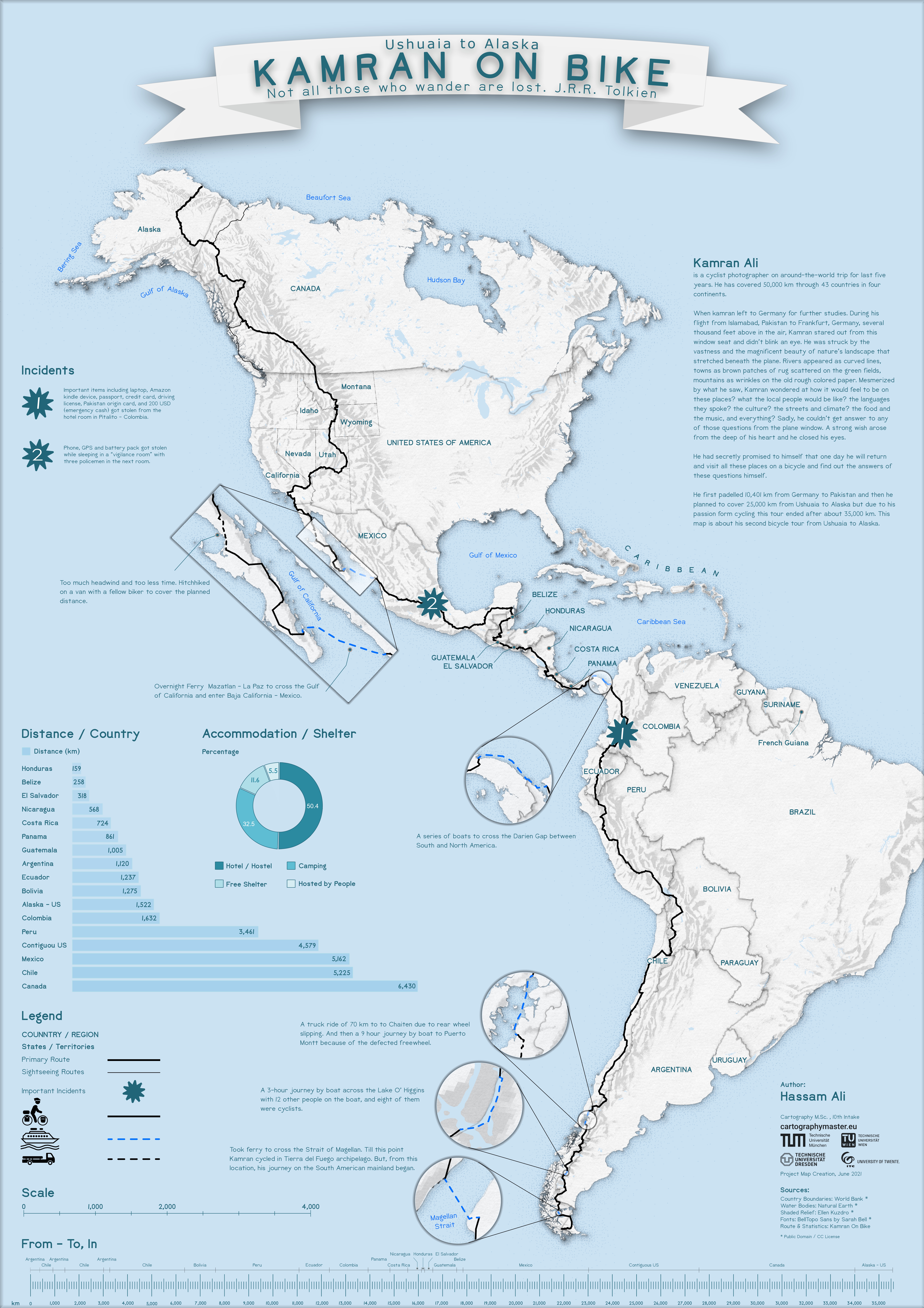
Kamran Ali, widely known as Kamran On Bike, originally from Layyah, Pakistan is an adventure cyclist and photographer who has been traveling the world on his bicycle for over a decade. His cycling journey began in 2011 with an ambitious trip from Germany to Pakistan, covering around 4,500 kilometers across multiple countries.
After finishing his education in Germany and working as a computer programmer, he decided to pursue his passion. Since 2015, Kamran has cycled more than 63,000 kilometers through 58 countries across four continents. One of his notable achievements is becoming the first Pakistani to cycle the entire length of the Americas—from the southern tip of Argentina all the way to Alaska—covering roughly 33,000 kilometers.
All the content on this website and associated pages is the exclusive property of Hassam Ali and is protected by international copyright laws. Any reproduction, redistribution, scraping, training of AI models (including but not limited to machine learning and large language models), or any other form of automated or manual data extraction is strictly prohibited without prior consent. Unauthorized use may result in legal action.